Mount Irau via Corrybas Hike
8/28/20231 min read
Gunung Irau is the highest peak in the popular Cameron Highlands, a plateau developed in the 1930s and named after Scottish geologist William Cameron who first surveyed the area in 1885. The road winding up from Tapah to the main town of Tanah Rata is quite exhilarating and the region is an extremely popular tourist area today.
Located on the main Titiwangsa mountain range, Tanah Rata lies at an elevation of around 1,450m above sea level. The temperature is delightful and allows a wide range of plants to be cultivated, including fruit, vegetables and most notably tea – the vast Boh tea plantations cover the north-east end of the plateau. The main road in the Cameron Highlands runs between Tanah Rata, Brinchang (sometimes spelt Berinchang) and Kampung Raja near the tea plantations and there is a regular, cheap bus running back and forth throughout the day.
Itinerary
Height : 2110m
Distance : 16km
Inclined gain : 1100m
Difficulty : 6/10
Duration : 10-14 hrs
Event Type : Mountain Hiking
Group Size : Min 10, Max 30
Meetup : Hiker Paradise in Kampung Tersusun Mawar Tepian Desa
End Point : Hiker Paradise in Kampung Tersusun Mawar Tepian Desa
0600 - Meetup at Hiker paradise MTD, Prepare and Briefing by Leader & Guide
0630 - Start Hiking
0730 - CP Dingin, Regroup
0815 - Camp Valley, Regroup, Break 20 minutes
0835 - Continue journey
1010 - CP Champion, short break
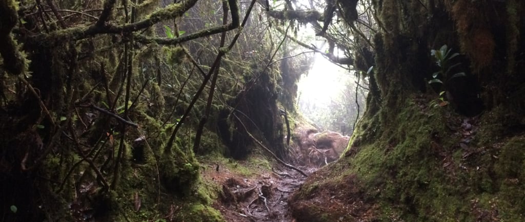
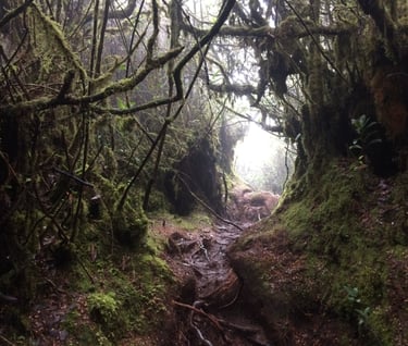
1030 - Thick and Superb Mossy Forest, CP Paradise
Photo Session for 20 minutes
CP Paradise Cut Off time 1050
1200 - CP Bonk
1300 - Gunung Irau - Lunch Break
1345 - Start Descent, Detour with same trail
1645 - Camp Valley
1830 - Hiker Paradise Lodge

Global Expedition Training Sdn Bhd [202101006083 (1406382-D)]
Kelab Expedisi Global (Global Expedition Club) (C-SGR-03425)
Persatuan Pembangunan Konservasi Hutan Global (PPM-018-10-29112023)
Corporate Office / Expedition Centre
Malaysia
Address: A10/2/2, One Ampang Business Avenue, Jalan Ampang Utama 2/2,
Ampang, 68000 Selangor, Malaysia.
Email : gecsales2026@gmail.com
Landline: +60350200558
Mobile no: +60192379653
Blogs....
1. Benefits of Hiking
2.
Overseas Office
Nepal Office :
House ,
Jalan Thamel, Kathmandu, Nepal.
Tanzania Office :
Arusha, Tanzania.
Blogs....
1. Benefits of Hiking
2.